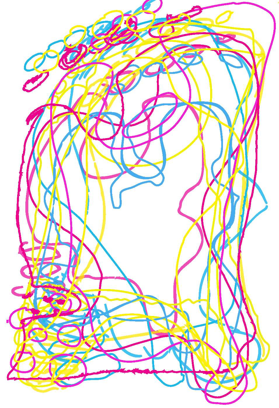
'Do you know what your country looks like?'
This is what I was wondering about my fellow country men and women; The Dutch, and it was the question that started this little project.
I asked various Dutch people to draw the outline of what they thought The Netherlands looks like from memory.
They had three colours to chose from; yellow, magenta, and cyan. I asked them to draw in one continuous line as much as possible.
I then placed all these drawings on top of each other.
What became clear is that the outline of the Netherlands is still pretty clear, especially the small islands (de waddeneilanden) in the upper left corner are clear in most people's memory
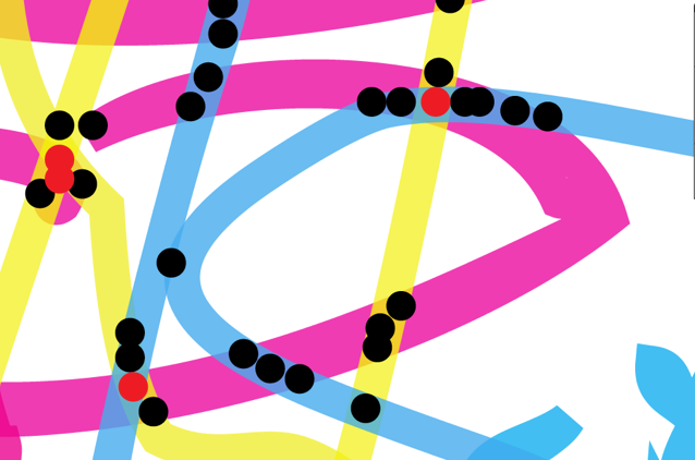
I wanted to experiment with what would be left of these drawn maps if one could only see where lines are crossing.
Because if multiple lines cross in one space, that part of the country is remembered by more people.
I looked at the places where two lines cross, and put a black dot on that spot.
Where more than two lines cross, I put a red dot.
Because if multiple lines cross in one space, that part of the country is remembered by more people.
I looked at the places where two lines cross, and put a black dot on that spot.
Where more than two lines cross, I put a red dot.
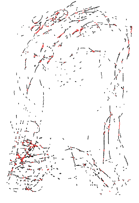
(a fun little manual job that took hours of my life to complete)
The result is that even without the coloured lines, you can see where the lines crossed and still see the shape of the country.
We can now see that the IJsselmeer (a pretty big lake for Dutch standards in the middle of the country) is often tragically forgotten. We only see a few black dots (2 lines cross) and no red dots at all (multiple lines cross).
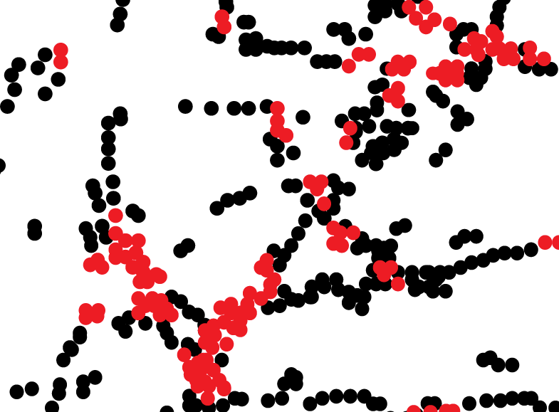
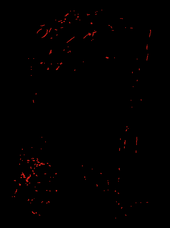
When you place the map over a black background you only see the red dots (the multiple crossing lines).
This way you get the best picture people have of The Netherlands, since the red dots show the parts most people remembered.
This way you get the best picture people have of The Netherlands, since the red dots show the parts most people remembered.
Conclusion:
When you look hard enough Dutch people do know what their country looks like – but don't think too much about the IJsselmeer.
When you look hard enough Dutch people do know what their country looks like – but don't think too much about the IJsselmeer.